What is a Watershed?
A watershed is a geographical area of land where all the rainwater, snowmelt, and other water drains downhill into a common body of water, such as a river, lake, or ocean. In the Scioto Watershed, that common body of water is the Scioto River.
Scioto River Characteristics
Tributaries, Neighborhoods, and History
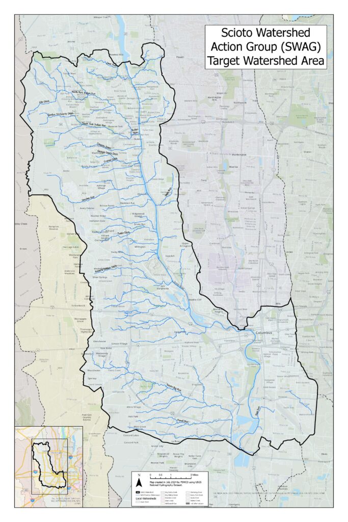
The Scioto River is fed by five main tributaries (and their sub-watersheds) from north to south: Indian Run, Hayden Run, Dry Run, Big Run, and Kian Run. These sub-watersheds include many smaller, often unnamed streams.
The area covers diverse neighborhoods, including Dublin, Hilliard, Upper Arlington, Grandview, Southwest Columbus, Franklinton, Downtown, Near East, and South Columbus, each with unique factors affecting water quality.
In the oldest parts of Columbus (Franklinton, Downtown, Near East), there are few visible streams. Since the city’s founding in 1812, streams in these areas have been altered, buried in culverts, or tunneled underground over the last two centuries.
Explore the Watershed with SWAG
The Scioto Watershed Action Group (SWAG) focuses on the urban segment of the river in Columbus and Franklin County, specifically from O’Shaughnessy Dam to I-270 on the south side. This focus was chosen because urban and rural water quality issues differ.
As a new volunteer group, SWAG is still learning about all the waterways in its focus area. Follow our progress and learn the story of each stream by clicking on the markers on the map. We plan to add stories for all streams as the group grows.